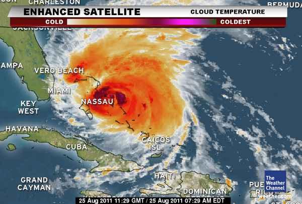
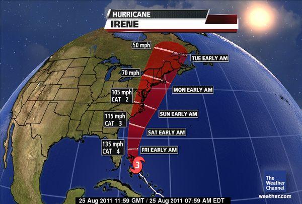
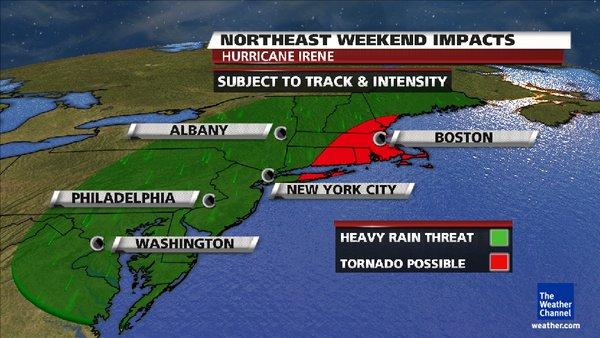
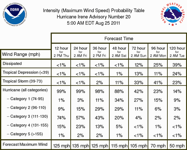
| 08/25/2011: Hurricane Irene, a large, powerful Category 3 hurricane, with winds of 115 mph, continues to plow through the Bahamas, with more impacts in its sights. As seen in the projected path map below, Hurricane Irene will be a dangerous hurricane as it tracks towards the East Coast this weekend.
As of Thursday morning, Irene is centered about 670 miles south of Cape Hatteras, North Carolina and moving NW at 13 mph. The first tropical storm and hurricane watches have been posted for the U.S., along the coasts of South and North Carolina.
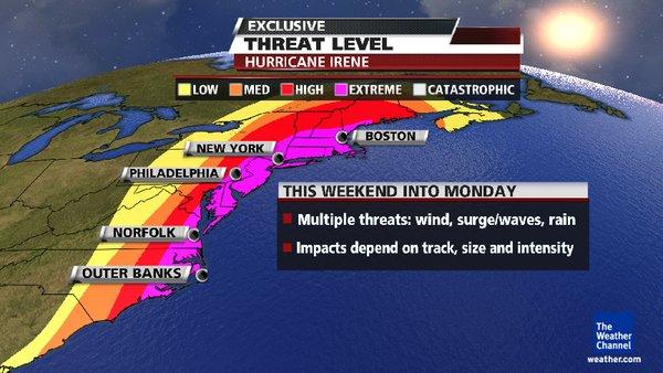
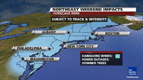
Irene has the potential to be a serious and multi-hazard threat for the major metropolitan areas of the Northeast along and east of the I-95 corridor. This includes Philadelphia, New York City, Hartford, and Boston. This hurricane has the potential to produce flooding rains, high winds, downed trees (on houses, cars, power lines) and widespread power outages. Significant impacts along the immediate coast include high waves, surge and beach erosion. The severity of the impacts will be determined by Irene's exact path and intensity, which remain uncertain at this time.
Irene will make its closest approach to the Carolinas late Friday night through Saturday. Northeast U.S. impacts would be this weekend into early Monday of next week.
Ridge VRS will update this story as conditions change.
For tips on preparing for the storm, read our online story:
http://www.ridgevrs.org/index.cfm?fs=news.newsView&News_ID=63
Photos courtesy of The Weather Channel |